
Like many of us, Turlock’s Tom Oakley was awakened Tuesday morning by the thunder and lightning show that blew into town at around 4 a.m.
The rolling thunder resulted in a sound alert on Oakley’s doorbell-camera app, and then he watched the sky light up via the camera from the comfort of his bed.
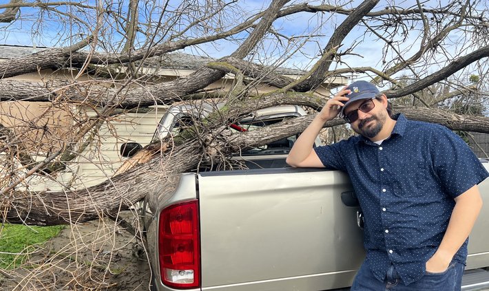
A few hours later, after the storm had subsided, Oakley walked out the front door of his east Turlock home, headed toward the driveway and stopped dead in his tracks.
A full-grown Modesto ash tree in his yard had been uprooted and toppled directly onto the roof of his silver Dodge Ram pickup — a scene that would’ve ruined most anybody’s day.
But Oakley, a music/computer science teacher, is a glass-half-full kind of guy.
“Well,” he thought to himself. “At least I won’t have to go to jury duty now.”
Indeed, the court excused Oakley and he spent the rest of his morning perusing insurance policies and making phone calls — like so many other Stanislaus County residents.
Since Saturday, Mother Nature has dumped 2.29 inches of rain on Turlock, according to Ryan Hollister, an earth sciences professor at MJC and Cal State Stanislaus who measures rainfall at his home near Turlock High School. This brings the year-to-date total to 12.06 inches (the water year begins on Oct. 1 and concludes on Sept. 30).
"I’ve been keeping track of rainfall at my house since 2012,” said Hollister, a Turlock native. “The highest yearly total was in 2016-17 when we got 20.42 inches. Right now, we’re ahead of that pace. But I should point out that last year at about Christmas time we were ahead of pace and then all of January was completely dry. We only had about another one and a half inches the rest of the (water) year.”
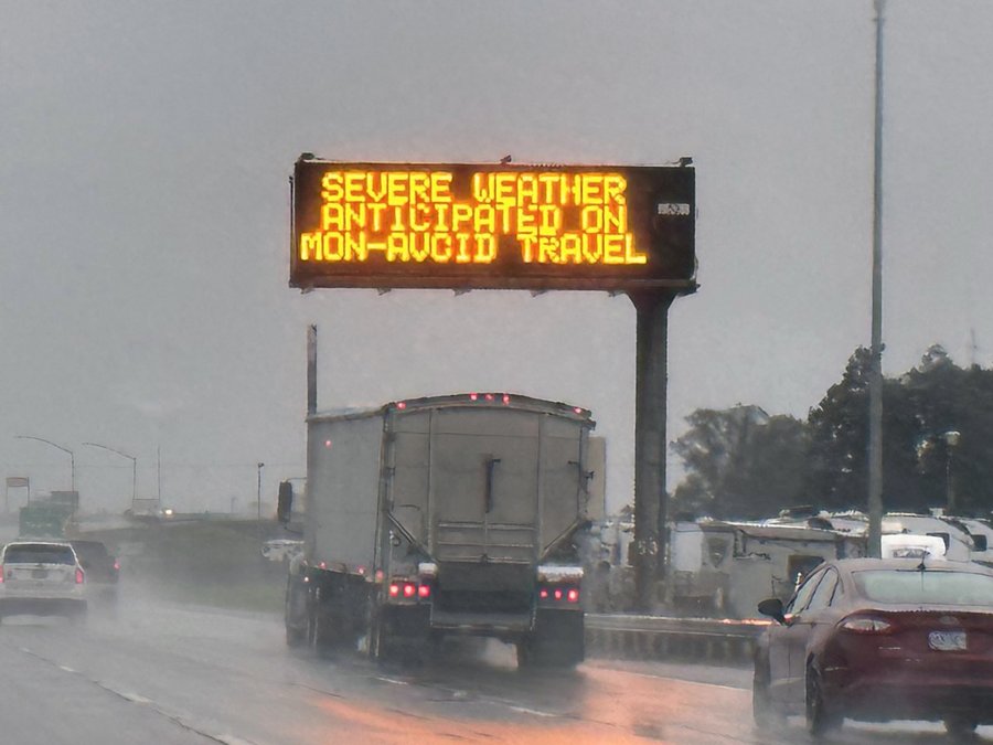
If January is going to dry out again in 2023, it won’t happen immediately, according to the National Weather Service.
"This weekend and early next week there’s the potential for moderate to heavy precipitation,” said meteorologist Idamis Del Valle-Shoemaker. “The region could potentially get one to two inches from that system, with the heaviest rainfall coming on Saturday and again on Monday.”
Another one to two inches could push Turlock’s year-to-date total close to 15 inches, well over its 30-year average of 12.74 inches per water year.
“What I try to get people to understand is that in California, there’s really no ‘average,’” said Hollister. “It’s always feast or famine. Really dry or really wet. It only averages out to a mean of 12.74.”
In addition to Tuesday’s thunder and lightning show, Modesto, Ceres and Keyes received a tornado warning, a rare phenomenon in these parts.
“The tornadoes here are totally different from the tornadoes in the Midwest,” said Hollister. “The reason we got the tornado warming was that on radar we could see the heavier bands of rain staring to wrap around. Instead of going to the northeast like the whole front was, some of the rain was wrapping around to the southwest. It made a small little hook, which is a sign of rotation. That rotation can sometimes spawn tornadoes.”
The thunder and lightning storm stretched from Merced — where residents along the south side of Bear Creek were evacuated at 2 a.m. and sheltered at the county fairgrounds — all the way north to Yuba City, a distance of nearly 200 miles.
“I normally don’t hear weather when I’m sleeping, but it woke my dogs,” said Amanda Shelton, a school office manager in Turlock. “I saw the lightning and heard the thunder and I realized what was going on. I just watched and listened to the show for about half an hour.”
Turlock Mayor Amy Bublak also was awakened in the early morning hours.
“I like the sound of thunder, but I always get worried by the lighting,” Bublak said. “I always hope it doesn’t hurt anybody or anything and I worry about providing services and keeping everybody safe during storms like these.”
As of Tuesday, Turlock had experienced only minor flooding of some streets and parking lots. But Modesto Deputy Fire Chief Darin Jesberg, who serves as the public information officer for the Central Valley Incident Management Team (which includes Turlock), reminds residents to be cautious.
“We’re focusing primarily on the Dry Creek drainage and that doesn’t affect Turlock, necessarily,” said Jesberg. “We’re watching the Tuolumne and Stanislaus rivers, as well, but right now there’s not a big concern. The water managers are managing flows very effectively. But with the increase in precipitation and run-off, all low-lying areas are subject to flooding. We’re urging the community to be vigilant and aware of their surroundings at all times.”
On Tuesday evening authorities ordered the evacuation for the Newman area that is near the San Joaquin River and east of River Road. The order includes Catfish Camp on Crows Landing Road and all the homes on the east side of River Road to Hills Ferry Road.