After more than three weeks of being obscured by thick tule fog, the sun finally made an appearance on Wednesday, sending many scurrying outdoors to soak up some much needed Vitamin D.
Hope you enjoyed it, because it’s going to be a while before we see it again.
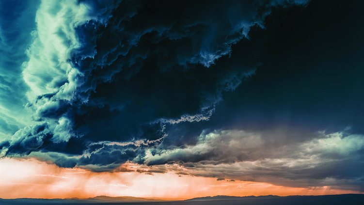
Scott Rowe, a senior service hydrologist and meteorologist with the National Weather Service in Sacramento, advises to make sure your umbrellas and windshield wipers are in working order.
“The last three or four weeks, we’ve been under the influence of high pressure,” said Rowe. “We’re transitioning to a stormier pattern through next week with a series of atmospheric rivers impacting California.”
The 2025-26 water year got off to a rollicking start for Turlock with 5.22 inches of rain between Oct. 1 and Nov. 18 — a 428 percent increase of it’s typical total of 1.22 inches by that time, according to Ryan Hollister, an instructor at Stanislaus State and Modesto Junior College. The three-day total of 2.74 inches between Nov. 15-17 was a record for Turlock in November.
But the high pressure moved in shortly thereafter and the region was socked in by fog for nearly a month.
Rowe said the region will start to see moderate to heavy rain this weekend, continuing through next weekend.
“Probably not a whole lot of rain to start with,” said Rowe. “It will target Northern California and the mountains, and Turlock will be on the cusp of storm No. 1, with about a quarter inch of rain through (today) for you guys. But the show will just be getting started at that point.”
Sunday through Tuesday is expected to bring 2 to 3 inches of rain to the region. Then, another 3 inches is expected through the following weekend for a two-storm total of about 6 inches.
“What you’re seeing outside today is associated with a storm system,” said Rowe. “We’re going from gloomy weather to stormy weather, with minimal sunshine in between. That high pressure associated with the tule fog has exited the area and we are now being influenced by low pressure.”