Flooding is expected to occur city-wide this weekend as a severe storm that the City of Turlock said is “typically experienced only once in a decade” is forecasted to bring three to four inches of rainfall to Turlock.
The City of Turlock said that the duration and intensity of this weekend’s storm will likely create localized street flooding and storm water could spill over curbs and sidewalks. To lessen the storm’s impacts, residents are encouraged to clear leaves from storm grates, park cars in driveways and avoid driving through flooded areas. The City also urges residents to use caution to drive around City employees and other utility providers who may be working in the streets.
“Turlock has one of the best storm drain systems in the entire region, but it still takes time for our streets to drain with this much rain,” said Mayor Gary Soiseth. “Our staff is prepared for the downpour, but you can also prepare by picking up sandbags from the City and clearing your street gutters and drains of leaves. I ask all residents to be patient as our staff work around the clock to drain our streets during the storm.”
According to the National Weather Service office in Sacramento, an area flood watch will go into effect at 8 a.m. Saturday until 8 a.m. Monday. A flood watch means that there is a potential for flooding based on current forecasts and those living in areas prone to flooding should be prepared to take action should flooding develop.
There will be a 20 percent chance of rain after 10 p.m. on Friday with new precipitation amounts of less than a tenth of an inch possible. There will be an 80 percent chance of rain during the day Saturday, followed by a 100 percent chance of rain Saturday night. Sunday will also have a 100 percent chance of rain during the day followed by a chance of more rain Sunday night through Monday.
The coming storm is prompting the Stanislaus National Forest toclose roads and day-use areas in Groveland and Summit districts that are at high risk for landslides or flooding.
“We’re closing these areas because they are prone to landslides or flooding during rain events,” said Jim Junette, Groveland District Ranger. “We want to be sure visitors don’t get caught on the wrong side of a landslide or flash flood, since the area is expecting as much as seven inches of rain next week.”
Junette said the areas will reopen as quickly as possible, but it will depend on whether they experience problems. “We don’t have a specific reopening date and won’t have one until we can get in and assess whether they have been impacted by the weather.”
This rainfall is expected to build on precipitation already brought in by a series of storms that affected the region this week. According to data as of 4 p.m. Thursday from Turlock Irrigation District, the region has already experienced .56 of an inch of rainfall since the beginning of this month.
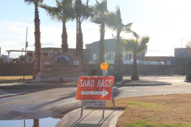
Sandbags are available free of charge at the City’s Water Quality Control Facility located at 901 South Walnut Road. The City of Turlock does not deliver sandbags.
For any further questions, contact the City of Turlock Municipal Services at 668-5590.