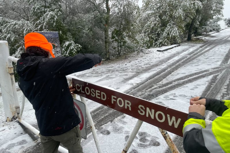
Turlock residents may not need travel far this weekend to build a snowman as a winter storm is expected to create “significant” snowfall and at elevations where snow is unusual. In fact, residents of nearby Oakdale were able to bust out their corncob pipes and button noses earlier this week as flurries reached the east Stanislaus County town.
Whether or not flurries make it to Turlock, rainfall is expected in the area throughout the weekend and into Tuesday.

Those with weekend travel plans may want to reschedule as blizzard warnings were posted in the Sierra Nevada and Southern California mountain ranges, where as much as 5 feet (1.5 meters) of snow was expected. Temperatures could drop far below normal in the region, posing a special risk to homeless people.
“Simply put, this will be a historic event for the amount of snow over the higher peaks and lower elevation snow,” according to the regional weather office.
Interstate 5 was closed south of the Oregon border as snow fell to the floor of the Sacramento Valley and in a high mountain pass north of Los Angeles, where blizzard warnings were in effect. Avalanche warnings were posted in some areas, and flash flood warnings were issued for Los Angeles and nearby coastal areas.
The storm has added to major precipitation from December and January “atmospheric rivers” that improved California’s drought outlook, but authorities who allocate water to farms, cities and industries remain cautious because of a recent history of abrupt changes in hydrologic conditions.
Winter storms across the country have been causing havoc this past week.
The winter storms have blacked out nearly 1 million homes and businesses from coast to coast, closed major roads, caused pileups on highways and snarled air travel. More than 1,200 flights were canceled and more than 17,000 were delayed Friday across the U.S., according to FlightAware.com.

Few places were untouched by the wild weather, including some at the opposite extreme: long-standing record highs were broken in cities in the Midwest, mid-Atlantic and Southeast.
In Wyoming, rescuers tried to reach people stranded in vehicles but high winds and drifting snow created a “near-impossible situation” for them, said Sgt. Jeremy Beck of the Wyoming Highway Patrol.
“They know their locations, it’s just hard for them to get them,” he said.
Wyoming's Transportation Department posted on social media that roads across much of the southern part of the state were impassable.
In the Pacific Northwest, high winds and heavy snow in the Cascade Mountains prevented search teams from reaching the bodies of three climbers killed in an avalanche on Washington’s Colchuck Peak over the weekend. Two experts from the Northwest Avalanche Center were hiking to the scene Wednesday to determine if conditions might permit a recovery attempt later this week.
Powerful winds were the biggest problem in California, toppling trees and power lines. By Wednesday evening, more than 65,000 customers in the state were without electricity, according to PowerOutage.us.
A 1-year-old child was critically injured Tuesday evening when a redwood crashed onto a home in Boulder Creek, a community in the Santa Cruz Mountains south of San Francisco, KTVU reported.
“Nearly the entire population of CA will be able to see snow from some vantage point later this week if they look in the right direction (i.e., toward the highest hills in vicinity),” UCLA climate scientist Daniel Swain tweeted.
Much of Portland, Oregon was shut down with icy roads not expected to thaw until Saturday after the city’s second-heaviest snowfall on record this week — nearly 11 inches.
A more than 200-mile (320-kilometer) stretch of Interstate 40 from central Arizona to the New Mexico line closed due to snow, rain and wind gusts of up to 80 mph (129 kph). More than 8,000 customers were without power in Arizona.
In the northern U.S. — a region accustomed to heavy snow — the snowfall could be significant. More than 18 inches (46 centimeters) may pile up in parts of Minnesota and Wisconsin, the National Weather Service said Wednesday evening. According to the weather service, the biggest snow event on record in the Twin Cities was 28.4 inches (72 centimeters) from Oct. 31 through Nov. 3, 1991.
Temperatures could plunge as low as minus 20 degrees Fahrenheit (minus 29 degrees Celsius) Thursday and to minus 25 F (minus 32 C) Friday in Grand Forks, North Dakota. Wind chills may fall to minus 50 F (minus 46 C), said Nathan Rick, a meteorologist in Grand Forks.
Wind gusts may reach 50 mph (80 kph) in western and central Minnesota, resulting in “significant blowing and drifting snow with whiteout conditions in open areas,” the weather service said.
In Michigan, hundreds of thousands of people remained without power Friday after a storm earlier this week coated power lines, utility poles and branches with ice as thick as three-quarters of an inch. Gov. Gretchen Whitmer called Friday for more accountability on restoration efforts by the state’s two largest utilities.
At one point, more than 820,000 customers in Michigan were in the dark. By Friday, that was down to under 600,000, most in the state's populous southeastern corner around Detroit. But promises of power restoration by Sunday, when low temperatures were expected to climb back above zero (minus 18 Celsius), were of little consolation.
As the northern U.S. dealt with the winter blast, National Weather Service meteorologist Richard Bann said some mid-Atlantic and Southeastern cities set new high temperature marks by several degrees.
The high in Lexington, Kentucky, reached 76 F (24 C), shattering the Feb. 22 mark of 70 F (21 C) set 101 years ago. Nashville, Tennessee, reached 78 F (26 C), topping the 1897 record by 4 degrees. Indianapolis, Cincinnati, Atlanta and Mobile, Alabama, were among many other places seeing record highs.
— The Associated Press contributed to this report.


